Deutsche Telekom starts offering transport and crisis management system developed in the Czech Republic to Central European Countries
21.04.2016Company: T-Mobile Czech Republic a.s.
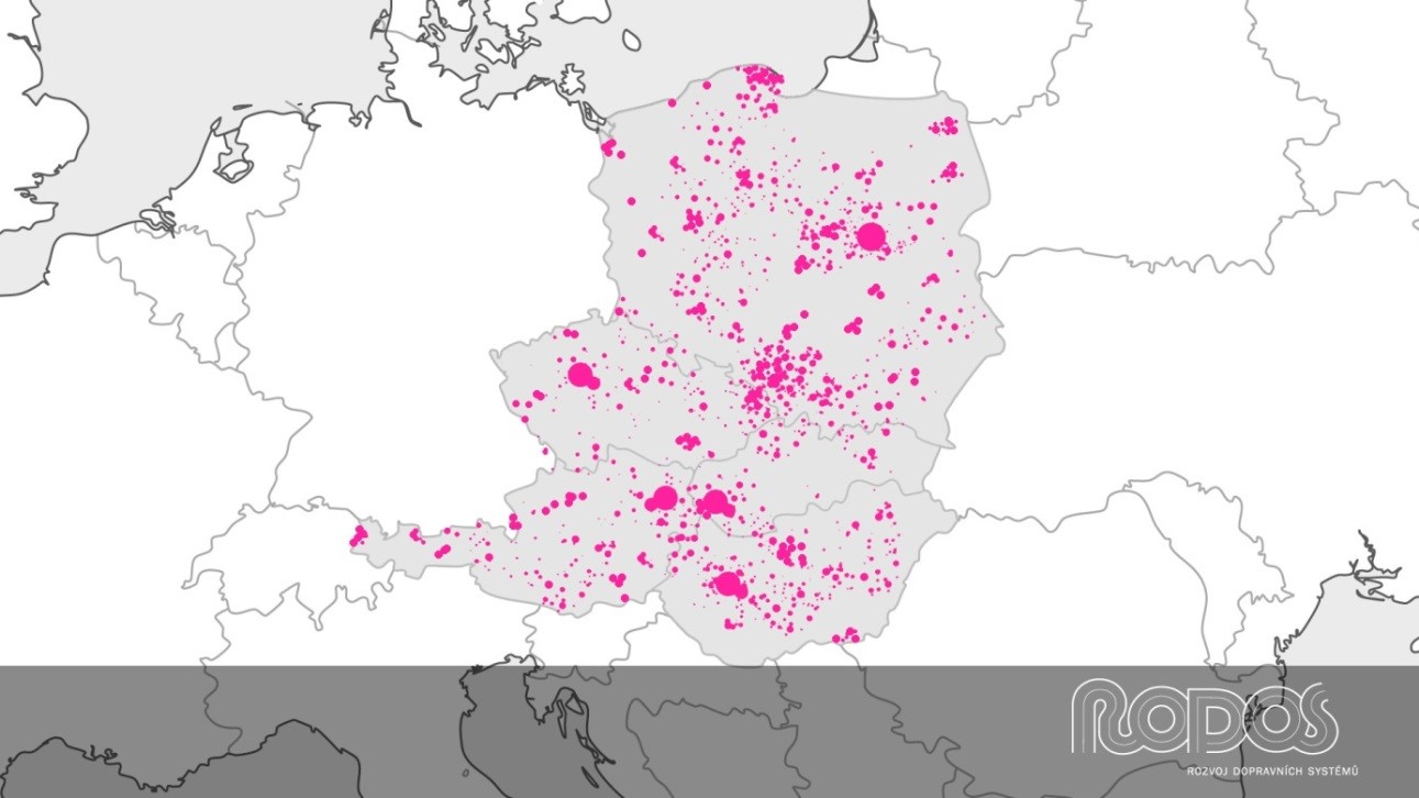
entral Europe Mobility Atlas (CEMA) is a mobility monitoring and management system developed in cooperation between T-Mobile and VŠB – Technical University of Ostrava
The solution was conceived and tested in the Czech Republic and will be gradually implemented in Poland, Austria, Slovakia, Hungary, Croatia and Slovenia
CEMA uses anonymised data from the mobile network and connected on-board car units
Czech engineers, analysts and developers have been honoured by Deutsched Telekom’s choice of the Central Europe Mobility Atlas solution, which it will implement in several European countries. The system was developed by T-Mobile Czech Republic in cooperation with VŠB – Technical University of Ostrava within the Transport Systems Development Centre (RODOS, Centrum pro rozvoj dopravních systémů) platform. Deutsche Telekom presented the solution today at the Transport Research Arena (TRA) 2016 conference in Warsaw.
“For technology companies, current mobility monitoring poses a major challenge, particularly in respect of real-time collection and evaluation of a large amount of data. We are happy that our long-term cooperation with the Technical University of Ostrava has borne fruit and Deutsche Telecom has selected our solution, which has already been successfully operated in the Czech Republic, for deployment in other Central European countries,” says Lukáš Kovárník, ICT Solutions Development Manager at T-Mobile.
“CEMA is a one-of-a-kind system which for the first time in history combines anonymised mobility data from different countries so that the provided information gives a global picture of the situation,” explains Martin Hájek, Head Manager of the RODOS centre, adding: “One of the reasons for developing the system was the lack of comprehensive information that would allow analysis and estimation of mobility dynamics (position and mobility of people) in a larger number of territorial units, including border areas, almost instantly.”
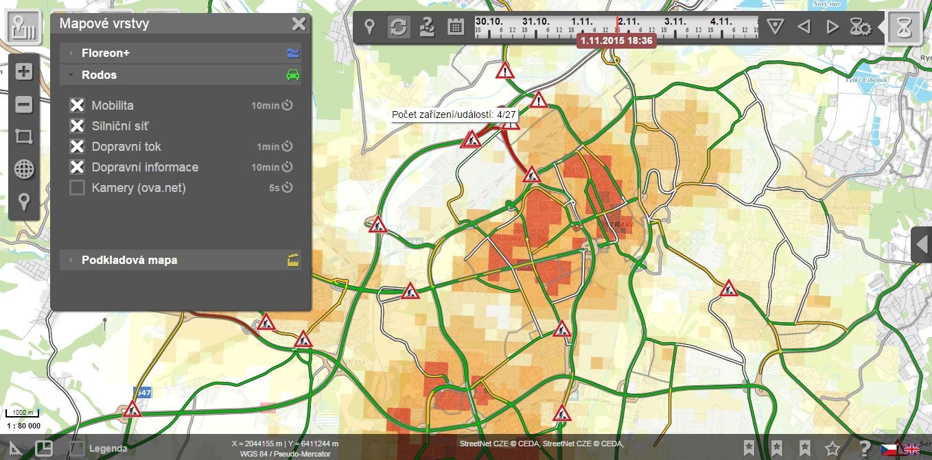
The technical solution is based on analyses of data from multiple sources including anonymised big data provided by the mobile operator and obtained from the mobile network, connected GPS on-board units (OBU) sharing their position, and an analysis of previous crisis situations, such as floods. As input data are processed in real time, the system responds immediately and can thus instantly inform, for example, the integrated rescue system units which in turn can quickly get ready and respond in time. In the event of a crisis, information from CEMA helps to efficiently manage and resolve the situation.
However, CEMA offers a variety of applications also in other areas: online information and information history from this system can significantly influence decisions to be taken in planning public transport and transport infrastructure construction, and facilitate more efficient decision-making in tourism and other sectors that are dependent on human mobility. CEMA is also one of the key technological components of the Smart Cities concept.